
Antique Blaeu Map of America Terra Australis Incognita, 1642
€9,500

You are now following Wall Decor. You can manage alerts in your account settings.
You have unfollowed Wall Decor.
Unfortunately, this action has failed. Please refresh the page and try again.
You have added this product to your wishlist.
You have removed this product from your wishlist.
Unfortunately, this action has failed. Please refresh the page and try again.
You can view your wishlist here.
Antique Blaeu Map of America Terra Australis Incognita, 1642
Antique Turkey in Asia Map with Cyprus and the Holy Land, 1760

Edwardian Brass Illuminated Way Out Sign, 1890s

Antique Chart of the Atlantic Ocean, 1870

Antique Map of Turkey in Asia, 1750

Antique Map of Prussia and the German States, 1870

Antique Map of the Haut-Rhin with Colmar and Marshal Lefebvre, 1860

Antique Map of Alsace-Lorraine, 1871

Antique Map of Turkey in Asia, Ottoman Anatolia, Syria and Iraq, 1795

Antique Map of Turkey in Asia by Dower, 1845

Antique Map of Europe from Blacks General Atlas, Edinburgh, 1870

Antique Chart of the World, 1870

Antique Map of Turkey in Asia, Armenia and Mesopotamia, 1760

Antique Map of Middle East and Afghanistan with Statistics by Philip, 1856

Antique Star Chart of Both Celestial Hemispheres, 1870

Antique Map of Prussia and the South German States from Blacks General Atlas, 1870

Antique Map of Western Asia, Mediterranean to the Indus and Arabia, 1870

Antique Map of Turkey in Asia with Tableland Profile by Dower, 1845

Antique Chart of the World, 1870

Antique Asia Minor Map with Classical Regions by Pluche, 1765

Antique Map of Turkey in Asia with Blue Draped Cartouche, 1760

Antique Map of the World in Two Hemispheres with Rivers and Mountains, 1870

Antique Map of Sweden and Norway with the Baltic Sea from Blacks General Atlas, 1870

Antique Map of Judaea or the Holy Land with Twelve Tribes, 1800

Antique Map of the World on Mercators Projection from Blacks General Atlas, 1870

Antique Map of the Mediterranean Basin, 1903

Antique Map of Cincinnati The Queen City by Ran McNally, 1899

Antique Map of Manhattan, New York City with Central Park from Rand McNally, 1899

Madonna attributed to Luigi Brusotti for Fontana Arte, 1950

No. 5. Acrylic Glass Advertisement Display with Lights from Coco Chanel, 1980s

Solar System Map of Planetary Orbits with Data Chart, 1857

Antique Architectural Plan of Château De Fontainebleau, Napoleon Residence, 1803

Map of Saint Domingue, Haiti and Dominican Republic, 1793

Antique Map of Jamaica and Hispaniola, 1802

Vintage Map of London, 1930

Alexander the Great's Empire Map, 1800s

World Map Featuring Captain Cooks Exploration Routes and Polar Views, 1787

Ancient Bosphorus and Byzantium Map from Ambroise Tardieu, 1825

Map of the New Philippines and Early 18th Century Spanish East Indies, 1706

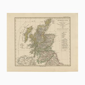
Map of Scotland with Highlands, Islands, and Northern England, 1858
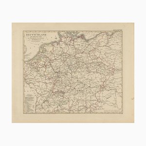
Antique Map of Germany's Railway Transport Network, 1857
Map of the Ottoman Empire and Near East, 1571

The Provinces of Scotland Map, 1660

Antique Blaeu Map of Styria in Southeastern Austria, 1600s

Antique World Map of Mercator's Projection with Ocean Currents and Trade Routes, 1903

Antique Austria-Hungary Map from Bartholomew, 1884

French Poster by André Bermond for Druckerei Moullot, 1930s

Meiji-Era Map of Tokyo by Sakai Kinzaburo, 1885

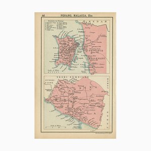
Miniature Map of Penang and Malacca and Negri Sembilan by John Bartholomew, 1908
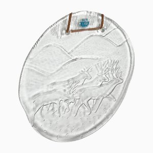
Vintage Glass Wall Plate with Reindeer Design from Meri Lasi
Antique Map of European Turkey by Pierre Antoine Tardieu

Map of Southwestern Germany and Switzerland Bavaria, 1858

Map of Ancient Assyria

Map of Ancient Attica, Megara and Euboea from Ambrose Tardieu, 1824

Charlemagne's Empire Map by Wilkinson, 1817

Historical Map of the Duchy of Lauenburg by Johann Baptist Homann, 1720

Map of Charente-Inférieure France with La Rochelle and Coastal Vineyards, 1850

Map of Côtes-Du-Nord France with Saint-Brieuc and Brittany Coastline, 1850

Antique Map of the Gulf of Mexico and Caribbean Islands by Tardieu, 1802

Antique Map of New Zealand with Inset of Auckland, 1882

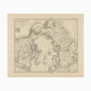
Arctic Polar Map of the North Pole and Russian Empire Regions, 1857
Map of the Rhine River in the Holy Roman Empire by Janssonius, 1640s

Holy Land Map of Palestine with German Biblical Text, 1650s

Antique Map of the Ottoman Empire, 1780

Antique Map of British South Africa, 1920s

Map of Ardennes in France with Sedan and Military History by Vuillemin, 1850s

Map of Cher France with Bourges, 1850

Art Deco Brass Internalite Illuminated Toilet Signs, 1920s, Set of 2

Antique Stellers Eider Duck Lithographs with Male and Female Pair, Sweden, 1929, Set of 2

Antique Merganser Duck Lithographs, Sweden, 1929, Set of 6

Guadeloupe and Dependencies Map

Antique Dutch Map of the Twelve Tribes of Israel After Ezekiel, 1730

Map of Portugal's Atlantic Archipelagos, 1903

Map of Arabia Tirion, 1730

North-East Africa Map with Egypt, Abyssinia, Sudan and Somaliland, 1902

Vintage Map of Central London from Bartholomews, 1920s

Maps of Europe by Andriveau-Goujon, 1849, Set of 2

Antique Map of Asian Turkey and Levant and Mesopotamia by Tardieu, 1802

Map of Cape Verde and the Mouth of the River Niger by Coronelli, 1691

Map of Aube, Troyes and Champagne in France, 19th Century

Map of Bouches-Du-Rhône France with Marseille and Rhône Delta, 1800s

Hand-Colored Map of Mexico with Tehuantepec Inset from Johnson's, USA, 1864

Map of the Margraviate of Brandenburg by Giacomo Cantelli Da Vignola, 1687

Antique Map of the Black Sea and Crimea by Pierre Antoine Tardieu, 1802

Map of Argentina, La Plata, Chile, Paraguay, Uruguay, and Patagonia, 1882

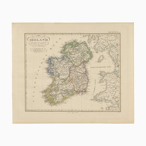
Map of Ireland with Provincial and County Divisions, 1851
Large Hand-Colored Map of Cambridgeshire by Greenwood, 1834

Ancient Black Sea Map, Pontus Euxinus and Sea of Azov from Ambroise Tardieu, 1825

Antique Map of Georgia and Tartary, 1780

Original Tobacco Advertisement, 1890s

Large Map of Russian Discoveries in Siberia, 1784

Map of India and Ceylon with Inset of Calcutta and the Ganges by Bonne, 1780

Early Woodcut Map of Franconia and Surrounding Regions, 1628

Antique Map of the Frankfurt Region by Johannes Janssonius, 1650

Antique Map of the Antilles and Central America, 1872

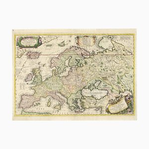
Large Coronelli Map of Europe with Mythical Islands and Rich Detail by Enzo Mari, 1692
Trending