
Antique Breconshire Map from Joan Blaeu, Wales, 1660
€1,354

You are now following Charts. You can manage alerts in your account settings.
You have unfollowed Charts.
Unfortunately, this action has failed. Please refresh the page and try again.
You have added this product to your wishlist.
You have removed this product from your wishlist.
Unfortunately, this action has failed. Please refresh the page and try again.
You can view your wishlist here.
Antique Breconshire Map from Joan Blaeu, Wales, 1660
Vintage British Excelsior IV Nautical Patent Log in Wooden Case from Thomas Walkers & Son, 1940s

Antique Asia Minor Map from Tallis with Rhodes and Olympus Vignettes, 1851

Antique Map of Mexico with Valley of Mexico Inset by Rand McNally, 1899

Antique Blaeu Map of Normandia, Amsterdam, 1642

Antique Blaeu Map of Brittany, Upper and Lower Brittany, 1642

Antique Blaeu Map of the Loudunois, Anjou and the Mirebalais, 1642

Antique Blaeu Map of Touraine, Tours and the Loire Valley, 1642

Antique Blaeu Map of Quercy, Cahors and the Perigord Border, 1642

Antique Blaeu Map of the Diocese of Sarlat in Perigord After Tarde, 1642

Antique New Testament Map with Plan of Jerusalem attributed to Bonne, 1770

Antique Blaeu Map of Provence, Nice and the Mediterranean Coast, 1642

Antique Blaeu Map of Languedoc, Orange and the Comtat Venaissin, 1642

Antique Blaeu Map of Africa, Madagascar and the Barbary Coast, 1642

Antique Blaeu Map of America Terra Australis Incognita, 1642

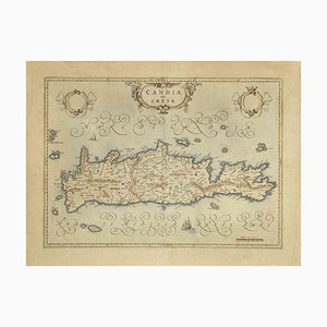
Map of Crete Etching by Johannes Blaeu, 1650s
Biblical Map of Africa and Middle East and Beyond

Antique Belgian Elizabethan Map of Wales from Humphrey Llwyd, 1592

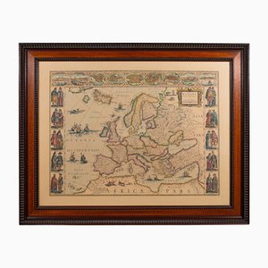
Vintage Reproduction of 17th Century Map of Europe, 1970s
Antique English Map of Breconshire by John Speed, 1627

Antique Print of Batavia Capital of the Dutch East Indies by Van Der Aa, 1725

Antique English Georgian Region Map of South Wales by John Cary, 1810

Antique Turkey in Asia Map with Cyprus and the Holy Land, 1760

Antique Map of the Creuse, Gueret and Felletin by Vuillemin, 1860

Antique Map of Turkey in Asia, Arabia, and Afghanistan by Hachette, 1860

Antique Map of Palestine with the Twelve Tribes by Dower, 1835

Antique Chart of the Atlantic Ocean, 1870

Antique Map of Asia Minor, 1845

Antique Map of Turkey in Asia, 1750

Antique Map of Prussia and the German States, 1870

Antique Map of the Haut-Rhin with Colmar and Marshal Lefebvre, 1860

Antique Map of the Rhone with Lyon and Ancient Lugdunum, 1860

Antique Map of Alsace-Lorraine, 1871

Antique Map of Turkey in Asia, Ottoman Anatolia, Syria and Iraq, 1795

Antique Map of the Haute-Saone, Vesoul and Gray by Vuillemin, 1860

Antique Polar Bear Print with Bats and Hedgehog and Wolverine, 1890

Antique Map of Turkey in Asia by Dower, 1845

Antique Solar System Chart with the Seasons and Phases of the Moon, 1870

Antique Map of the Vendee, Noirmoutier and the Ruins of Tiffauges, 1860

Antique Map of French India, Pondichery and Chandernagor, 1860

Antique Map of Vienne, Poitiers and Cardinal Jean Balue, 1860

Antique Map of Martinique, Fort-Royal and the Caravelle, 1860

Antique Map of the Saône-Et-Loire, Mâcon and Chalon by Vuillemin, 1860

Antique Map of the Somme with Amiens and Abbeville, 1860

Antique Map of Europe from Blacks General Atlas, Edinburgh, 1870

Antique Map of the Sarthe, Le Mans and the Jurist Denizot, 1860

Antique Italian Map of Turkey in Asia by Buffier, 1780s

Antique Grizzly and Black Bear Print with Wolf and Fox and Raccoon, 1890

Antique Map of the Seine with Paris and Its Suburbs, 1860

Antique Map of Guadeloupe with Marie-Galante and the Saintes, 1860

Antique Chart of the World, 1870

Antique World Map of the French Colonies in Four Continents, 1860

Antique Map of Turkey in Asia, Armenia and Mesopotamia, 1760

Antique Map of the Bas-Rhin with Strasbourg and Kleber, 1860

Antique Map of Middle East and Afghanistan with Statistics by Philip, 1856

Antique Star Chart of Both Celestial Hemispheres, 1870

Antique Map of Prussia and the South German States from Blacks General Atlas, 1870

Antique Tiger and Puma Print with Wildcat and Martens, 1890

Antique Map of Western Asia, Mediterranean to the Indus and Arabia, 1870

Antique Map of Turkey in Asia with Tableland Profile by Dower, 1845

Antique Chart of the World, 1870

Antique Plan of Paris and Its Fortified Enceinte by Vuillemin, 1860

Antique Map of Ancient Syria with Elephant Cartouche by Cluver, 1697

Antique Asia Minor Map with Classical Regions by Pluche, 1765

Antique Map of Turkey in Asia with Blue Draped Cartouche, 1760

Antique Map of Seine-Et-Marne, Fontainebleau and Amyot, 1860

Antique Map of the Seine et Oise with Versailles by Vuillemin, 1860

Antique Map of Turkey in Asia by Vuillemin, 1845

Antique Map of Asia Minor by Pluche, 1765

Antique Map of the Var with Draguignan, 1860

Antique Map of the Vaucluse, Avignon and Petrarchs Laura, 1860

Antique Map of Deux-Sèvres, 1860

After W. H. Bartlett, Montreal, 1842, Paper

Antique Map of Tarn-Et-Garonne, Montauban and Castelsarrasin, 1860

Enslaved Workers Washing for Diamonds in Brazil Engraving, 1815

Antique Map of the Vosges with Epinal and Saint-Dié, 1860

Antique Map of the Haute-Vienne, Limoges and Marshal Jourdan, 1860

Antique Map of the World in Two Hemispheres with Rivers and Mountains, 1870

Antique Map of the Yonne, Auxerre, Vauban and Marshal Davout, 1860

Antique Map of French Algeria, Algiers and Abd El-Kader, 1860

Antique Map of the Tarn, Albi and the Navigator La Perouse, 1860

Antique Map of Sweden and Norway with the Baltic Sea from Blacks General Atlas, 1870

Antique Map of the March of the Ten Thousand, 1845

Map of Saint-Pierre with the Marquesas Islands and Nosy Be, 1860

Antique Map of Seine-Inférieure with Le Havre and Corneille, 1860

Antique Map of Judaea or the Holy Land with Twelve Tribes, 1800

Antique Map of Toronto with Queens Park by Rand McNally, 1899

Antique Map of the North West Territories before Alberta and Saskatchewan, 1899

Antique Map of the Ottoman Empire in Europe and Asia attributed to Bonne, 1780

Antique Map of Turkey in Asia, Afghanistan and Arabia by Malte Brun, 1830

Antique Map of the World on Mercators Projection from Blacks General Atlas, 1870

Antique Map of Bourbon with the Island Volcano, 1860

Antique Map of Middle East and Georgia by Bonne, 1780

Antique Italian Map of Middle East with Khorasan and the Gulf, 1820s

Antique Map of Europe Before the First World War by Rand McNally, 1899

Antique Map of French Senegal, Goree and the Fouta-Djallon, 1860

Trending