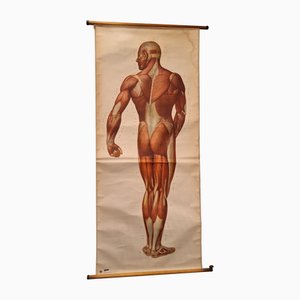
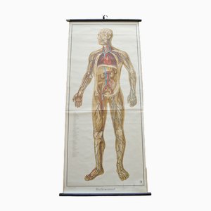
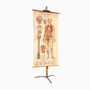
Vintage German Chart of the Human Body, Muscles, Germany, 1960
€650
You are now following Mid-Century Charts at Pamono. You can manage alerts in your account settings.
You have unfollowed Mid-Century Charts at Pamono.
Vintage German Chart of the Human Body, Muscles, Germany, 1960
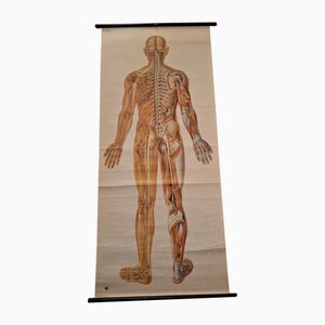
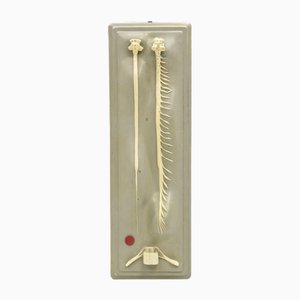
Anatomical Pull-Down Chart of the Human Body, Nervous System , Spine, Muscles & Tendons, Germany, 1960
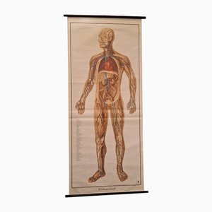
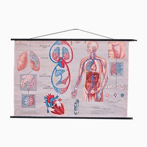
German Pull-Down Chart of the Human Body, Blood Circulation, Germany, 1960
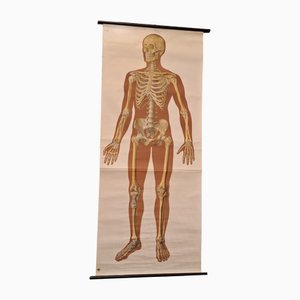
Anatomical Pull-Down Chart of the Human Body, Bones & Ligaments, Germany, 1960
Vintage Pull-Down Wall Chart, 1970
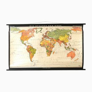
Vintage School/Teaching Card the States of the Earth by Haack-Painke for Justus Perthes Publisher, 1960s
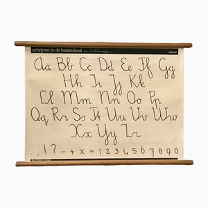
Vintage School/Teaching Card Latin Source Script from Röhr Verlag, 1940s

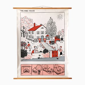
Vintage Teaching Card the Pim Family from Franz Cornelsen Verlag, 1960s
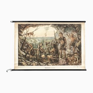
Charts of Maps from Ice Age Man
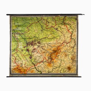
Charts of Physical Maps from North Rhine Westphalia NRW
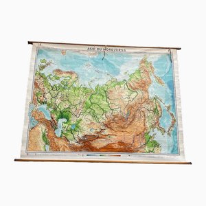
USSR School Chart
Vintage Scientific Educational Panel by Paravia Torino, 1960s
Vintage Scientific Educational Panel by Paravia Torino, 1960s
Vintage Wall Chart by Jung, Koch & Quentell for Hagemann, 1970s
Vintage School Wall Chart
Vintage School Chart by Young, Koch & Quentell for Hagemann, 1970s
Vintage School Wall Chart
Vintage School Wall Chart by Jung, Koch & Quentell for Hagemann, 1970s
Vintage School Wall Chart
Vintage School Wall Chart
Vintage School Wall Chart by Jung, Koch & Quentell for Hagemann, 1970s
VintageSchool Chart by Jung, Koch & Quentell for Hagemann, 1970s
Vintage School Chart by Jung, Koch & Quentell for Hagemann, 1970s
Vintage School Wall Chart by Jung, Koch & Quentell for Hagemann, 1970s

Vintage Wall Chart by Young, Koch & Quentell for Hagemann, 1970s
School Poster by Jung, Koch & Quentell for Hagemann, 1960s
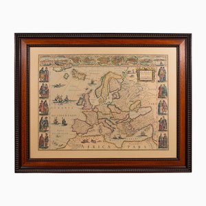
Vintage Reproduction of 17th Century Map of Europe, 1970s
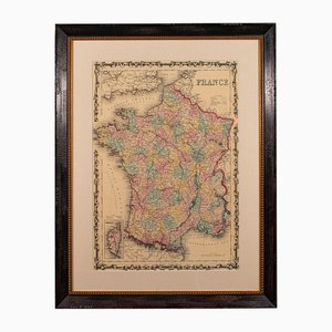
Large Vintage France Map, 1970s
Vintage School Wall Chart, 1950s
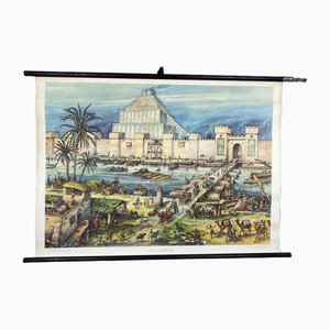
Vintage School Wall Card Print Live in Babylon Posters
American Red Cross Map of Italy, First World War, 1919

Blood Circulation Anatomic Wall Chart from German Health Museum Cologne, 1952
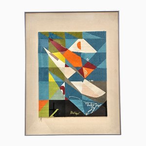
Key Largo Tapestry in Limited Edition by Mathieu Matégot
Vintage Wall Card Teaching Table by Linde Jung, Koch, & Quentell for Hagemann, 1970s
Vintage Teaching Board in Cherry by Jung, Koch & Quentell for Hagemann, 1970s
Vintage School Board by Jung, Koch & Quentell for Hagemann, 1970s
Vintage School Board by Young, Koch & Quentell for Hagemann, 1970s
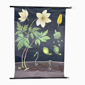
Vintage Wall Card Teaching Table Anemone by Jung, Koch & Quentell for Hagemann, 1970s
Vintage School Poster Canteens by Young, Koch & Quentell for Hagemann, 1970s
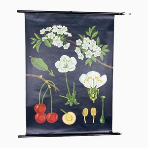
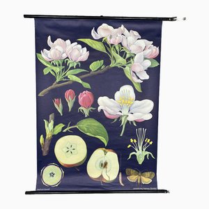
Vintage School Wall Card School Poster Edler Apple Tree by Jung, Koch & Quentell for Hagemann, 1970s
Nervous System Anatomical Wall Chart, Sweden, 1950s
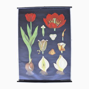
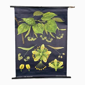
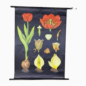
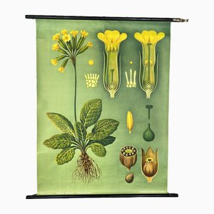
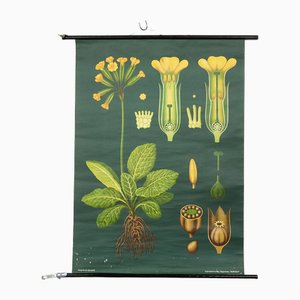
Vintage Botanical Wall Chart by Jung, Koch, & Quentell for Hagemann, 1960s
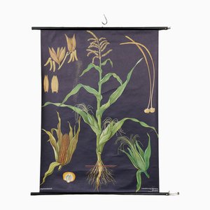
Botanical Corn Wall Chart by Jung, Koch, & Quentell for Hagemann, 1960s
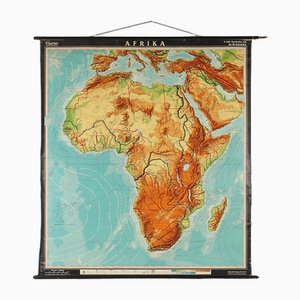
Large Africa School Map, 1950s
Pull-Down Chart, 1960s
Pull-Down Chart of Endocrine System, 1970s
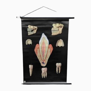
Pull-Down Chart of Human Teeth, 1960s
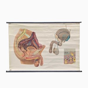
Male Anatomy Poster or Pull-Down Chart, 1950s
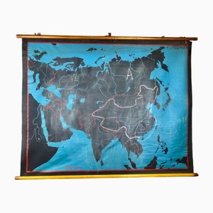
Beech Asia Map, 1940s
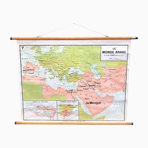
The Arabic World Pull Down Chart, 1960s
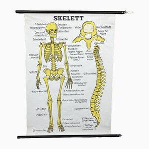
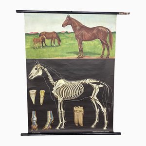
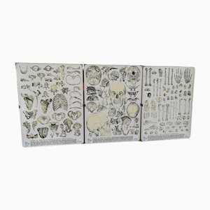
Vintage Skeleton Prints, 1960s, Set of 3
Vintage School Wall Chart, 1950s
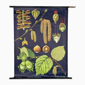
Maikchafer Botanical School Chart from Jung, Koch & Quentell for Hagemann Düsseldorf, 1970s

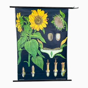
Sunflower Botanical Wall Chart by Jung, Koch & Quentell for Hagemann Düsseldorf, 1973
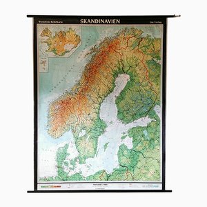
Mid-Century Relief Wall Card of Scandinavia by Wenschow for List Verlag, 1960s
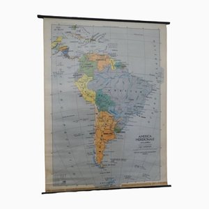
Southern America Map from IGDA Officine grafiche Novara, 1975
Vintage German Map
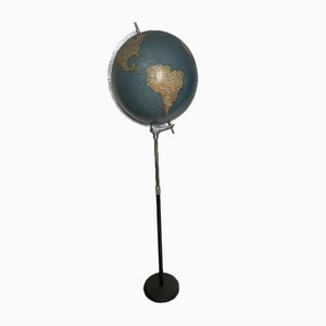
Italian Globe from The Ground
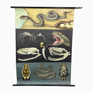
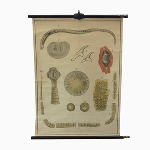
Vintage Educational Tapeworm Anatomy Chart, 1930s
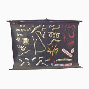
Vintage Educational Bacteria Chart, 1930s
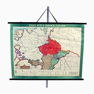
Vintage School Map of Czech State, Czechoslovakia, 1960s
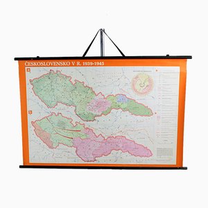
Vintage School Map of Czechoslovakia in 1939 1945, 1960s
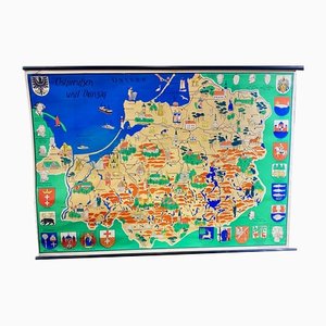
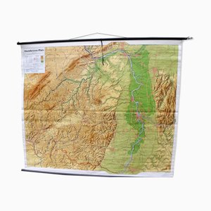
Mid-Century Map of the District of Rhineland-Hesse and Palatinate
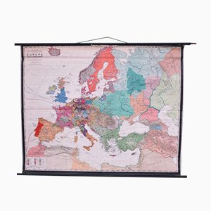
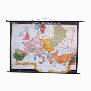
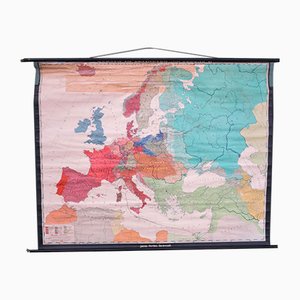
Vintage School Europe Wall Map by Leisering & Schulze for Velhagen, 1950s

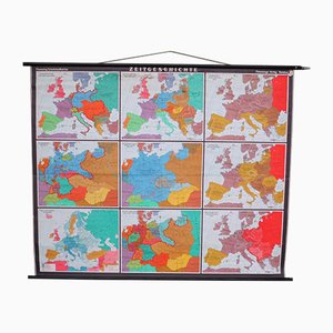
Large School Teaching Map on Contemporary History from Flemming Verlag Hamburg, 1950s
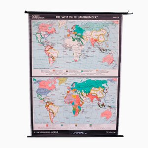
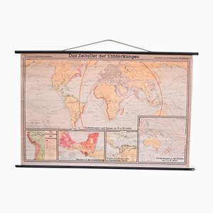
School Teaching World Map of the 19th Century from Velhagen & Klosing, 1961
School Teaching Map by Prof. Dr. W. Trillmich for Westermann Landkarten, 1950s
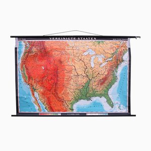
School Teaching Map of the USA from Justus Perthes Darmstadt, 1960s
School Teaching Map by Dr. Grummann for Gambke Berlin, 1960s
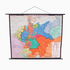
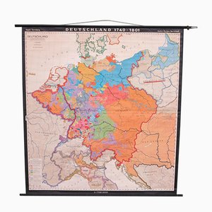
School Teaching Map of Germany from Flemming Verlag, 1950s
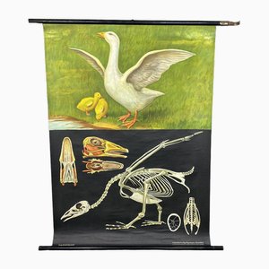
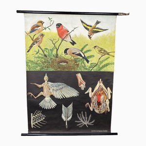
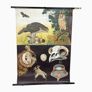
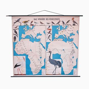
School Teaching Map of Birds from Verlag Jaeger Darmstadt, 1950s
School Teaching Map by Prof. Dr. Lauffer for Justus Perthos Darmstadt, 1950s
School Teaching Map of Warschow München, 1950s
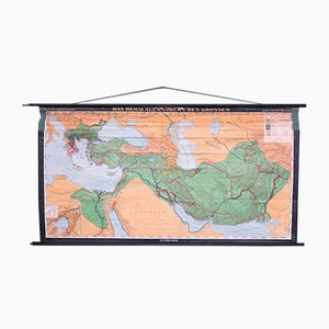
School Teaching Map of North Africa from Westermann Verlag, 1950s

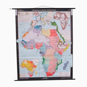
School Wall Map of Africa by Leisering & Schulze for Velhagen & Klasing, 1950s
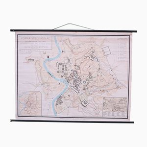
School Wall Map of Old Rome from Instituto Geografico de Agostini Nora, 1950s
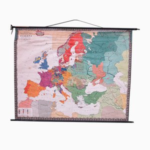
School Wall Map of Europe by W. Leisering for Velhagen & Klasing, 1950s
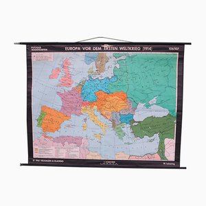
School Wall Map of Europe by Prof. Dr. Schmidt for Perthas Gotha, 1950s
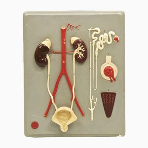
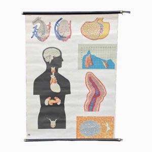
School Wall Map of the Human Body by Prof. Dr. med. W. Blotevogel for Hagemann Düsseldorf, 1950s
School Wall Map of Europe from Velhagen & Klasing, 1950s
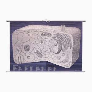
School Wall Map on Human Cells from Klett Verlag Stuttgart, 1976
School Wall Map of Germany by Haach Hertzburg for Perthes Darmstadt, 1950s
School Wall Map of Central Europe by Dr. W. Trillmich for Westermann Verlag, 1960s

School Wall Map of Europe by Prof. Dr. M. G. Schmidt for Perthas Gotha, 1950s
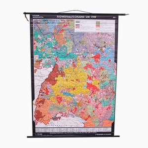
School Wall Map of South West Germany by Putzger for Velhagen & Klasing, 1950s
School Wall World Map by Haferland & Trillmich for Westermann, 1950s
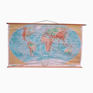
Vintage College World Map by Perthes Darmstadt, 1950s
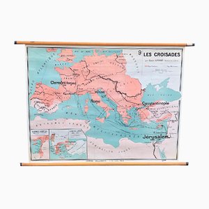
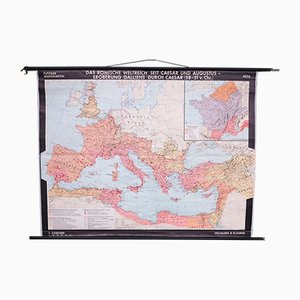
School Wall Map of the Roman Empire by Putzger for Velhagen & Klasing, 1950s
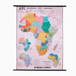
School Wall Map of Africa by Dr. E. Kremling for JRO, 1964
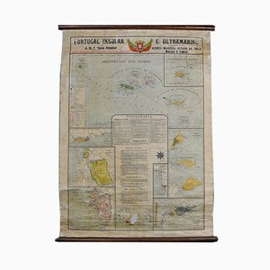
Map of Portugal and Overseas, 1960s
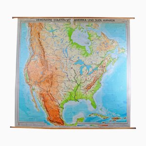
Map of United States by Georg Westermann, 1966
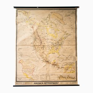
Mid-Century French Geographical America Map
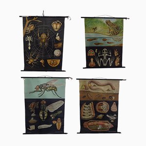
Austrian Educational Charts from Jung, Koch & Quentell, 1960s, Set of 4
Trending