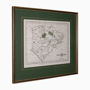
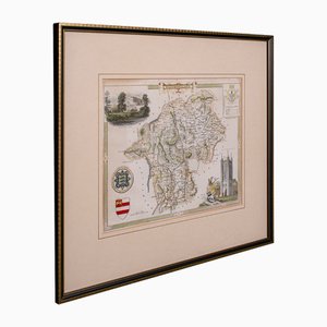
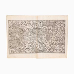
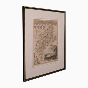
Dutch County Map of Cheshire by Janssonius, 1660s
€1,946

You are now following Vintage Charts online at Pamono. You can manage alerts in your account settings.
You have unfollowed Vintage Charts online at Pamono.
Dutch County Map of Cheshire by Janssonius, 1660s
English Collegiate Map, Cambridge, 1838

Georgian County Map Rutlandshire by John Cary
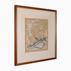
English Road Map Bristol to Weymouth

Antique English Georgian Framed Town Plan Map, 1780

Small English Country Map, Northamptonshire, 1850s

Coaching Road Map Cranborne to Dorchester

Large English Wimbledon Map SW London

Antique English Framed Cambridgeshire County Map by Robert Morden, Late 17th Century

Antique County Map by Robert Morden, 1700
Antique English County Map by Richard Blome, 1673

Large Antique Lithography Map of Northamptonshire by John Speed

Antique County Map, Northamptonshire, English, Framed Cartography, Richard Blome

Vintage Linen School Map the Scots Pine

Antique Lithographic Map of Warwickshire

Vintage German Chart of the Human Body, Muscles, Germany, 1960

Anatomical Pull-Down Chart of the Human Body, Nervous System , Spine, Muscles & Tendons, Germany, 1960

German Pull-Down Chart of the Human Body, Blood Circulation, Germany, 1960

Anatomical Pull-Down Chart of the Human Body, Bones & Ligaments, Germany, 1960

Vintage Pull-Down Wall Chart, 1970
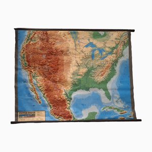
Large Sized Wall Chart, USA, 1980
Lithography Map Hampshire, England, 1850s

Taiwan Map from Dutch East India Company, 1724

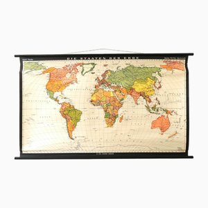
Vintage School/Teaching Card the States of the Earth by Haack-Painke for Justus Perthes Publisher, 1960s
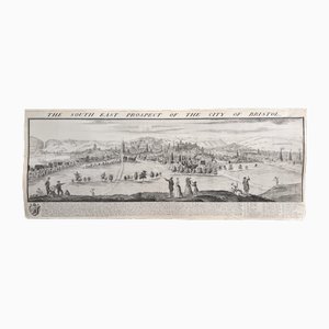
The South East Prospect of the City of Bristol by Samuel Buck, 1734
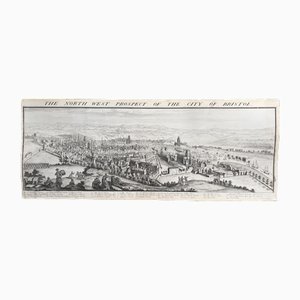
The North West Prospect of the City of Bristol by Samuel Buck, 1734
19th Century Butterflies and Birds Colored Framed Engravings, Set of 2

Large Antique Lithography Map of Kent, 1700

Vintage School/Teaching Card Latin Source Script from Röhr Verlag, 1940s

Antique Lithography Map

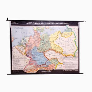
Vintage German School Map of Central Europe, 1961
Vintage Linen School Card Seals

Vintage Teaching Card the Pim Family from Franz Cornelsen Verlag, 1960s

Vintage Linen School Card

Victorian Lithographic Map with Environs of Southampton, England

Large Chart of Jamaica, 1753

Tourists Map of New Yorks Subway System, 1954

17th Century Prospect of Lisbon

Engraved Constellation Maps by W. Newton, Set of 5

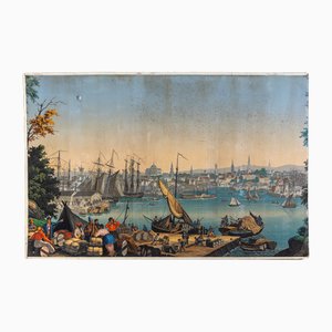
Boston Harbor from Views of North America from Zuber Et Cie, France
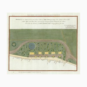
Early 19th Century Map for Houses in Hyde Park by J. Fordyce, 1809
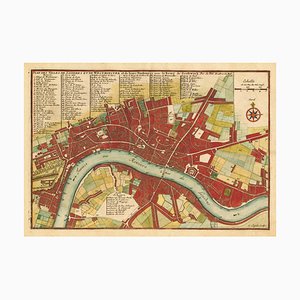
Large-Scale Survey of London Map with Marylebone & St Pancras

Large-Scale Survey of London Map with Knightsbridge

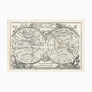
Miniature Double-Hemisphere World Map by J. Expilly, 1765
17th Century Miniature Map of Russia by Hondius, 1610

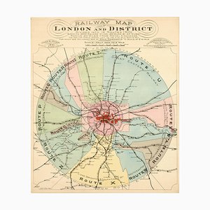
London's Railway Network, Late 19th Century
17th Century Miniature Map of Asia by N. De Fer, 1685

Early 18th Century Map of the British Isles by N. De Fer, 1705

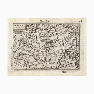
16th Century Miniature Map of Tartary by B. Langenes, 1599
16th Century Miniature Map of Ischia by B. Langenes, 1599

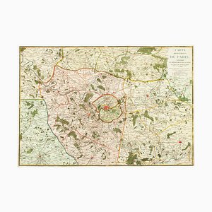
The Environs of Paris Map, Early 19th Century
Prospect of Munich, Early 18th Century

16th Century Map of Barcelona by Valegio, 1598

Map of the Oilfields in the Near East, 1955

Large-Scale Survey of London Map with St James's

Map of the City and University of Oxford by T. Moule, 1848

Mid-19th Century Plan of Constantinople by Sduk, 1840s

18th Century Miniature Map of the British Isles by M. Seutter, 1744

Early 18th Century Map of London by N. De Fer, 1705
18th Century Italian Map of the Cape of Good Hope by Albrizzi, 1740

Prospect of Bristol, 1600s

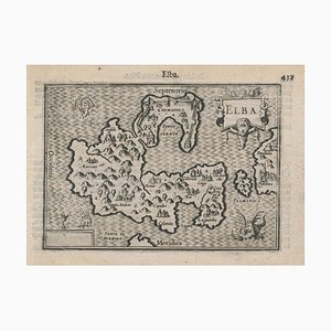
16th Century Miniature Map of Elba by B. Langenes, 1599
Mid-18th Century Map of Taiwan by Bellin, 1748

Victorian English Lithographic Map of Westmoreland
Map of Europe as a Queen from Buntings Itinerarium
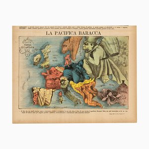
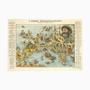
Italian Edition of Hadols Serio-Comic Map of Europe
18th Century Celestial Charts of the Northern and Southern Skies, Set of 2
Allegorical Map of England

Caricature Map of Ireland

16th Century Plan of Rome

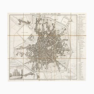
Early Town Plan of Milan

Rome's Pantheon, 1600s, Engraving

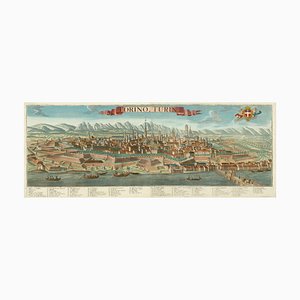
Prospect of Turin Map
19th Century Map of Milan (Italy) - Antonio Tua, 1840
A Prospect of the Great Fire of London, 1600s
Post-War Pictorial Wall Map of London

Pictorial Map of South Africa from the Second World War, 1940s

Spanish Sea Chart of Madagascar and Mozambique

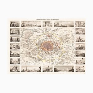
Paris and Surrounding Areas Map, Mid 19th Century
The Great Seal of the Commonwealth, 1651

Map of Classical Arabia

Map of the Middle East from Lafreri
17th Century Prospect of Venice

Italian Serio-Comic Map of Europe, 1871
Panorama of Stockholm

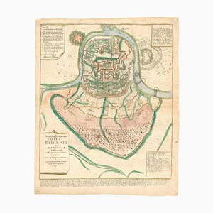
Plan of the Ottoman Siege of Belgrade, 1739
Tourists Plan of London for the Great Exhibition of 1851

Panorama of Vienna Under Siege by the Ottomans

Unusual Balloon View of Brighton, 1840s

Caricature Map of Italy

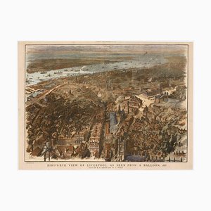
Balloon-View of Victorian Liverpool in Full Colour
Victorian English Lithographic Map of Cumberland
Venetian Edition of Danvilles Wall Map of Africa

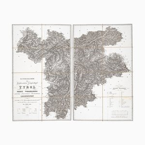
Detailed Map of Tyrol, Vorarlberg and Liechtenstein
17th Century Plan of Valletta

Mid-17th Century Map of the Far East

Trending