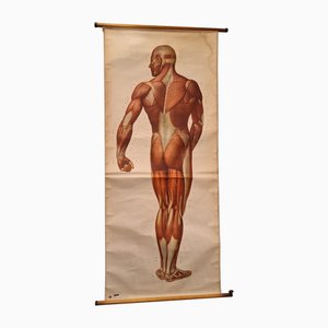
Vintage German Chart of the Human Body, Muscles, Germany, 1960
€650
You are now following Charts. You can manage alerts in your account settings.
You have unfollowed Charts.
Vintage German Chart of the Human Body, Muscles, Germany, 1960
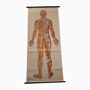
Anatomical Pull-Down Chart of the Human Body, Nervous System , Spine, Muscles & Tendons, Germany, 1960
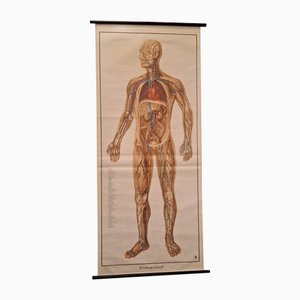
German Pull-Down Chart of the Human Body, Blood Circulation, Germany, 1960
Anatomical Pull-Down Chart of the Human Body, Bones & Ligaments, Germany, 1960

Vintage Linen School Card

Victorian Lithographic Map with Environs of Southampton, England

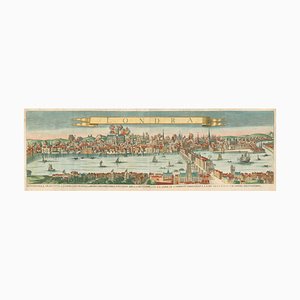
17th Century Prospect of Lisbon

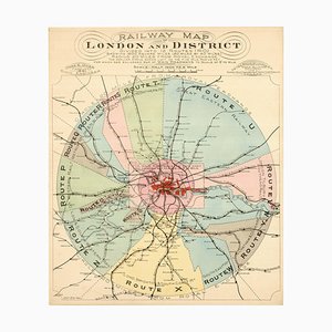
London's Railway Network, Late 19th Century
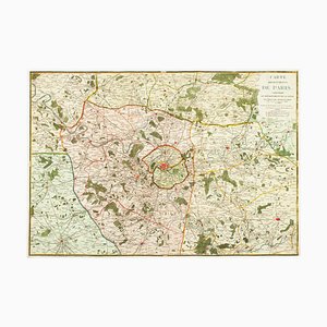
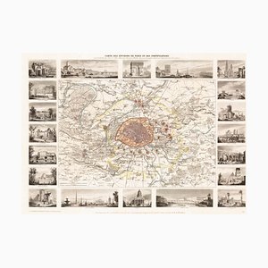
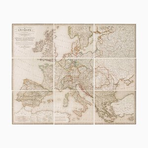
The Environs of Paris Map, Early 19th Century
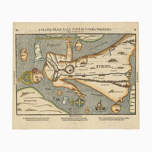
Map of Europe as a Queen from Buntings Itinerarium
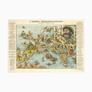
Italian Edition of Hadols Serio-Comic Map of Europe
Allegorical Map of England

Caricature Map of Ireland

16th Century Plan of Rome

Early Town Plan of Milan

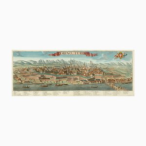
Prospect of Turin Map
A Prospect of the Great Fire of London, 1600s
Post-War Pictorial Wall Map of London

Pictorial Map of South Africa from the Second World War, 1940s

Paris and Surrounding Areas Map, Mid 19th Century
Map of Classical Arabia

17th Century Prospect of Venice

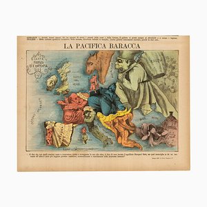
Italian Serio-Comic Map of Europe, 1871
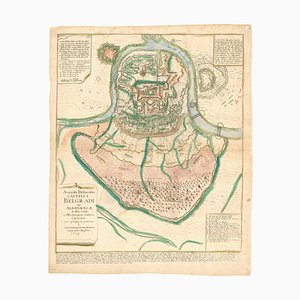
Plan of the Ottoman Siege of Belgrade, 1739
Tourists Plan of London for the Great Exhibition of 1851

Unusual Balloon View of Brighton, 1840s

Caricature Map of Italy

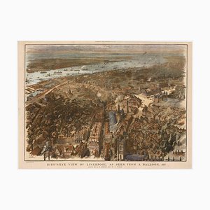
Balloon-View of Victorian Liverpool in Full Colour
Venetian Edition of Danvilles Wall Map of Africa

17th Century Plan of Valletta

Mid-17th Century Map of the Far East

Caricature Map of England and Wales

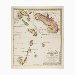
Early 18th Century Map of the Caribbean
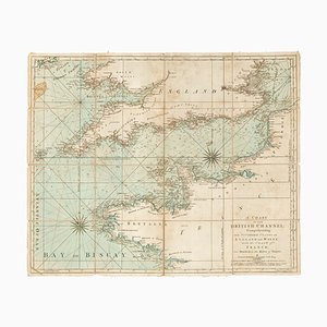
18th Century Sea Chart of the English Channel
The Route of the Spanish Armada Around the British Isles

Three-Sheet Map of the Russian Empire

Printed Map of London

Colourful Map of the History of London, 1970s

Napoleon in Exile on St Helena

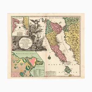
Map of Italy with Plans and Views of Cities

Pirate Edition of Morden & Leas Map of London

First State of the Tirion-Albrizzi Map of Japan

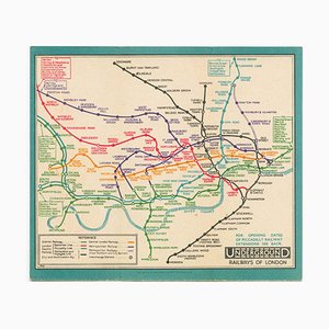
Last Pre-Beck Pocket Map of the London Underground, 1930s
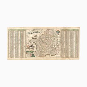
17th Century Map of France with Gazzetteer Side-Panels
Upside-Down Birds-Eye View of Italy from the Alps
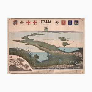
Chart of the Harbour of Havana

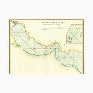
18th Century Map of the Persian Gulf
17th Century French Map of Arabia

A 17th Century Engraving of the Zodiac Sign Aries

Maps of the World & Continents, Set of 7

A Birds-Eye View of Paris

The Famous Sea-Monsters Map of Iceland, 1595

16th Century Dutch Map of Cyprus, 1598

Classic Carte-À-Figure Map of the Netherlands & Belgium

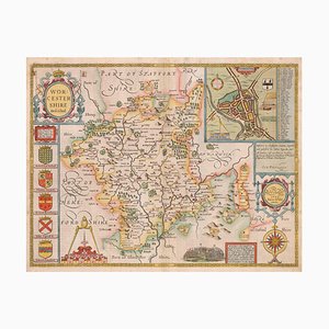
17th Century Map of Worcestershire, 1676
Celestial Charts with Christian Iconography, Set of 2

Map of New Zealand by Cook

Ptolemaic Map of Italy

Map of the Netherlands with a Fine Maritime Cartouche by Enzo Mari

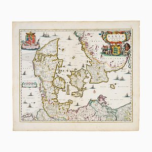
17th Century Map of Denmark
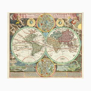
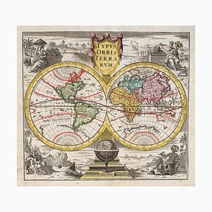
18th Century Double-Hemisphere World Map with Celestial Insets
18th Century Map of Corfu in Original Colour
18th Century Map Celebrating the Knights of Malta

A 17th Century Engraving of the Zodiac Sign Cancer

A 17th Century Engraving of the Zodiac Sign Leo

Map of Ancient Rome in the style of Ligorio, 1657

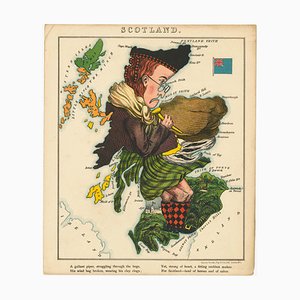
Satirical Map of Scotland
World Map as a Chocolatiers Competition, 1950s

Early 19th Century Original Table of Maritime Flags

A Birds-Eye View-Map of Malta

Prospect of Medieval London Bridge Covered with Houses

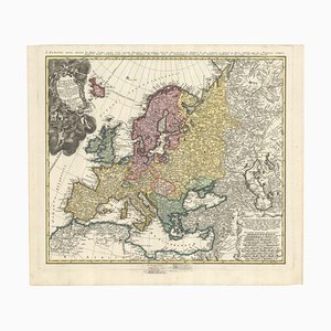
Mid-18th Century Map of Europe Showing the Spread of Religions
17th Century Map of Luxembourg

Map of the British Isles with Decorative Borders

18th Century Double-Hemisphere World Map
18th Century Map of Sicily

Mid-19th Century Town Plan of New York City

17th Century Wind Rose

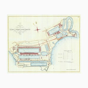
Detailed Plan of Londons Docklands
Detailed Map of Knightsbridge, Chelsea and Kensington

Wall Map of Europe Illustrated with Military Uniforms, 1890s

Early Prospect of Tokyo, 1700s

Diagram of the Seasons

Wall Map of Europe According to the Congress of Vienna
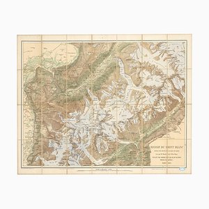
Map of the Mont Blanc Massif
Pictorial Map of Russia

Early 17th Century Map of Wales, 1619

Plan to Redevelop the Corner of Park Lane and Piccadilly

Map of the Environs of Hong Kong

18th Century Town Map of Peking

Classic 17th Century Carte-À-Figure Map of Spain

Detailed Town Plan of Madrid

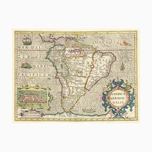
Early 17th Century Dutch Map of South America, 1633
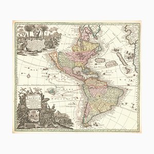
Map of The Americas with California as an Island, 1700s
Map of North America During the Mississippi Bubble

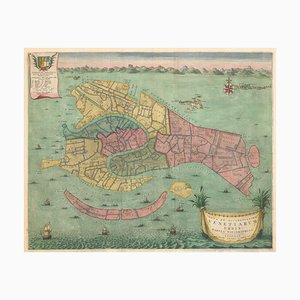
Early 18th Century Map of Venice
Trending